UK Earth Observation Experts to Study Ganga Plain
Published on by Water Network Research, Official research team of The Water Network in Academic
Britain’s earth observation community is linking with Indian experts to assess the impact of climate change and the associated greenhouse gas emissions on agriculture in the Indo-Gangetic Plain.

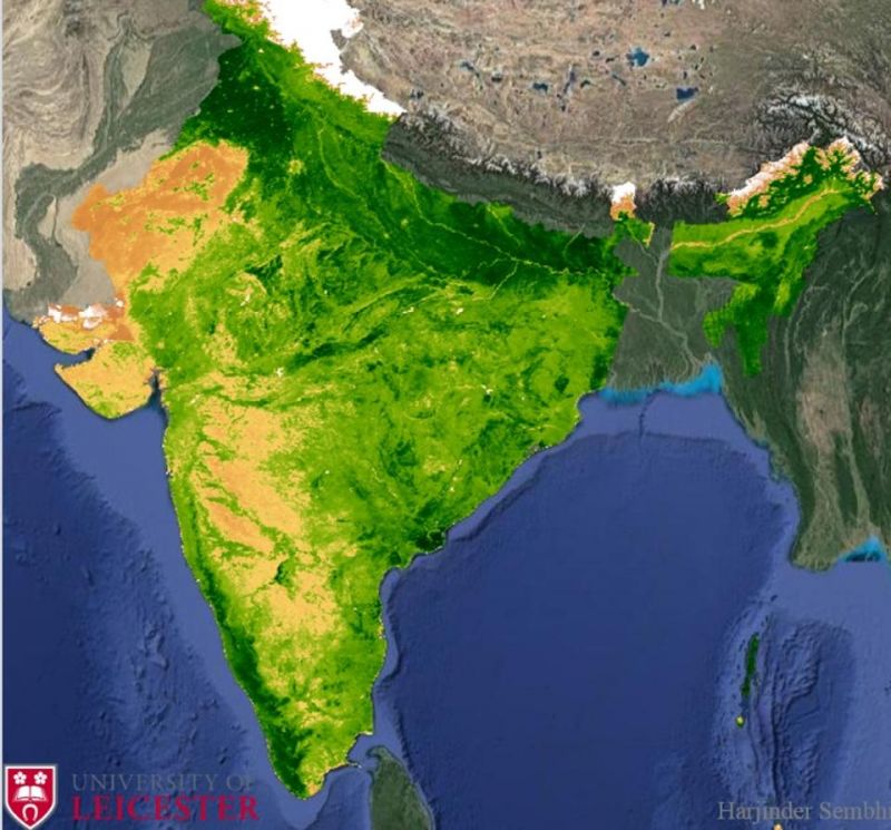
The normalised difference vegetation index (NDVI) over India, calculated from data collected by NASA’s MODIS space sensor. NDVI indicates the presence of live vegetation on earth’s surface — the deeper the intensity of green (as observed across north India), the denser the vegetation.(University of Leicester)
The project, funded by the UK-India Education and Research Initiative and the Department of Science and Technology, brings together experts from the University of Leicester and Indian Institute of Technology (Kanpur) to set up a new international research network.
The use of novel earth observation datasets used in the project is expected to provide a much better understanding of regional and long-term changes across the plains and how they impact agricultural yield.
The project links with researchers from the Centre for Climate and Landscape Research through the Leicester Institute for Space and Earth Observation and the Centre for Ecology and Hydrology in Wallingford through the National Centre for Earth Observation Science.
The plains extends across northern India, connecting to Pakistan, Bangladesh and Nepal, and is region of large scientific and economic interest.
The project’s context is the increasing agricultural production and industrialisation to meet the demands of a growing population, which means human-induced disturbances which threaten the natural ecosystem in this region.
Such changes have been observed to impact the quality of air and emissions of greenhouse gases and therefore the need to monitor land-use and the regional greenhouse gas budget is becoming critical, a release from the University of Leicester said.
In addition to these pressures, large climatic variations such as extreme changes in rainfall or temperature can also significantly impact crop productivity, food and water security in the future.
The project will focus on combining expert knowledge in Earth observation space sensors, highly accurate ground-based measurements with state-of-the-art models of the land surface to determine the climatic drivers of yield modulations and its relation to greenhouse gas emissions.
Read more at: Hindustan Times
Media
Taxonomy
- Agriculture
- GIS
- River Studies
- Ecosystem Management
- River Engineering
- River Restoration
- Rain Water Management
- GIS Spatial Analysis
- Agriculture
- Ecosystem
1 Comment
-
The study group should focus less on intensity of Flora as it is inevitable due to pressure of population. In fact, many geographies on the globe are culprits of not attempting intensive agriculture and it is criminal to incentivise farmers leaving of lands fallow.
More important is to inspect and study the impacts of loosely managed Collection, transport and treatment of Sewage/ waters in Soak pits, etc. and also the impact of (a) Collection and management of Organic Solid Wastes, management of cattle heads and Industrial gaseous emissions.